A lot has happened across the three Estonian restoration sites that form part of the WaterLANDS Action Site over the past year. Read the most important updates from the Kõrsa, Kikepera and Lavassaare sites below!
Restoration in Lavassaare in the final stage
Restoration works in the Lavassaare area started in February of 2025 and will be finished by the end of this year. The restoration area was divided into three sub-areas:
1. Lake Lavassaare area, protected area
40 peat dams were planned to be built within the area of Lavassaare, including 5 overflow dams. It was also planned to remove the forest that has grown around one of the ditches from an area of nearly 1 ha, in order to restore the conditions and area characteristic of an open bog. The work is in the final stage, and 6 dams are still to be built.
Five peat dams were built with the help of volunteers, and two dams will be built in the next volunteer season.
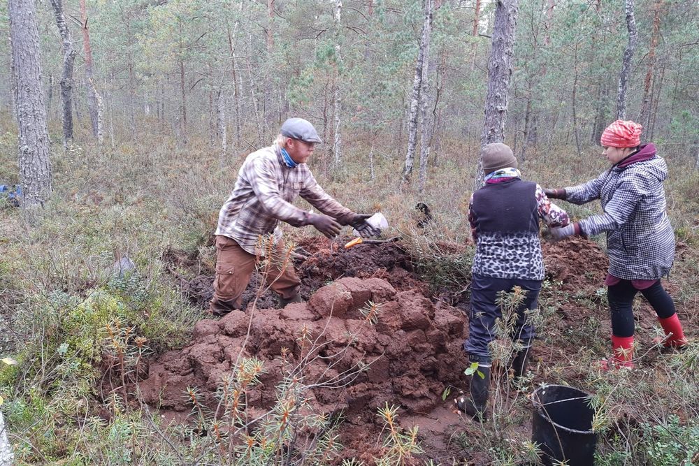
Volunteers building a dam in Lavassaare. Credits: Anneli Usutav
Restoration of the water regime leads to improvement of conditions of existing Natura 2000 habitats (7110, 7120, 91D0, 7140, 9080) in the Lavassaare Nature Conservation Area covering 186 ha.
2. Peat mining sites abandoned more than 30 years ago
Development of mining areas started here around the 1930s. Restoration aims to decrease peat mineralisation and stabilise the conditions for wetland development. Presently, some of the area has forest management on drained peat soils (drainage network from peat mining is still active), and also wetlands (shallow water-bodies, fens) have been established. The impacted area totals 468 ha.
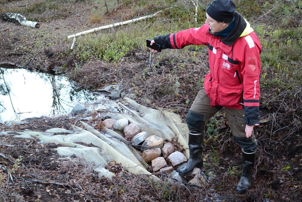
Jüri-Ott Salm (ELF) showing a well-functioning overflow dam in Lavassaare forest area. Credit: Ode Maria Punamäe.
The work is in its final stage with 118 out of 120 dams already established. Some of these are overflow dams to preserve preferred conditions for forestry (30 cm below ground level) or to stabilise the water levels in established wetlands (currently done mainly by beavers).
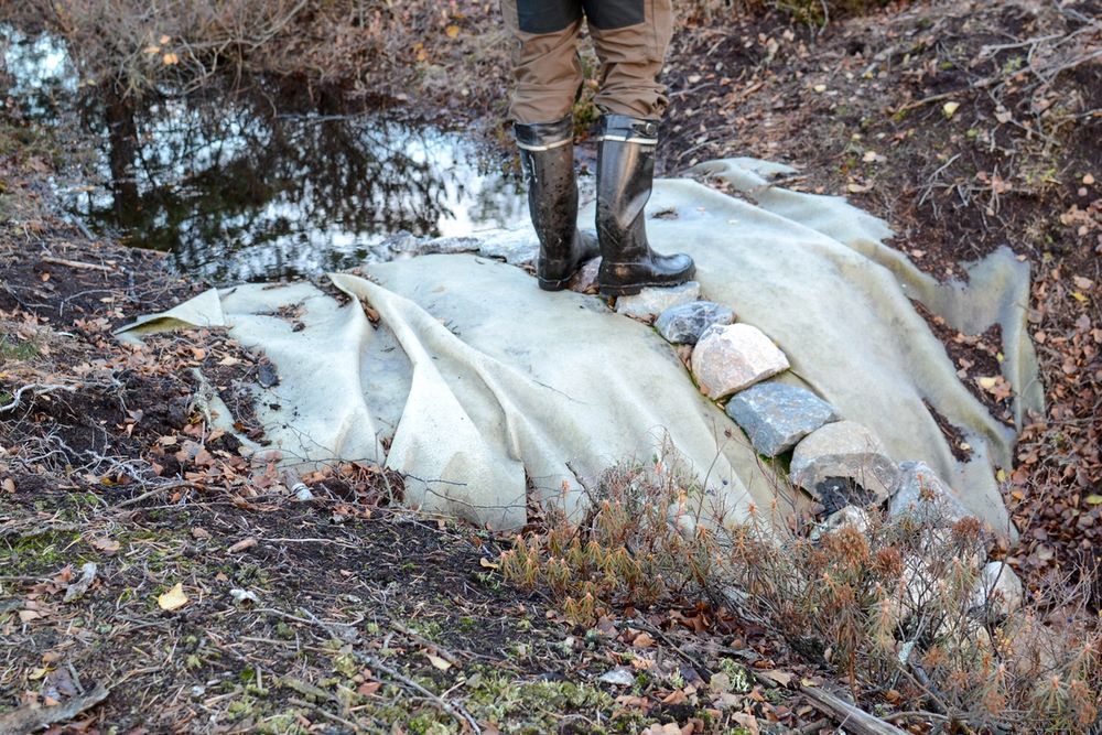
Overflow dam in the Lavassaare area made of peat, geotextile, and covered with stones to lead water flow into the centre.
In addition, an 830-meter-long dam was established to prevent drainage of 8 hectares of marsh (building process can be viewed on Youtube by Mati Kass). Another bigger soil work was related to levelling a former peat mining area covering 2.9 ha within and beside shallow water-bodies with the aim of creating open wetland habitat. The estimated amount of peat moved was around 11.500 m3. This work is expected to be finished mid-November.
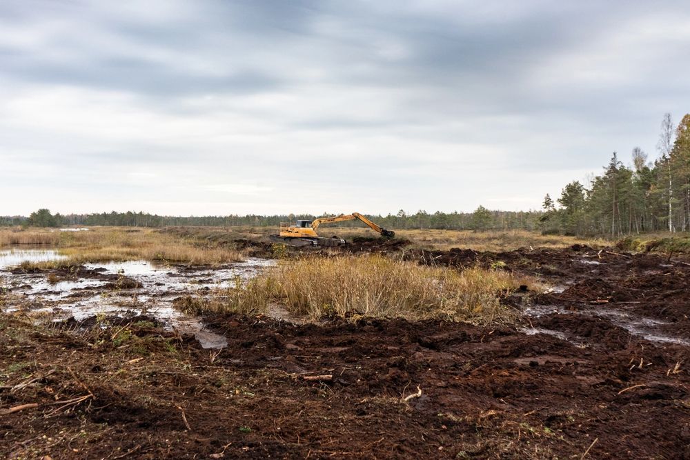
Levelling an abandoned peat mining area to create open wetland habitat. Credit: Anna Birgitta Erikson.
3. Peat mining sites abandoned less than 30 years ago
On the restoration area managed by Tootsi Turvas, 525 hectares of the depleted Lavassaare and Elbu peat production fields are being restored, with the work now in its final phase. The focus is on re-establishing the natural water level typical of bogs by dividing the area into smaller sections with peat embankments and raising the water level near the surface using overflow dams. Ditches have been closed or backfilled with peat, and steep slopes along former extraction fields have been levelled.
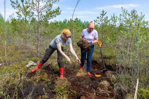
In drier and higher areas, biological restoration is underway, including sowing bog vegetation and planting trees.
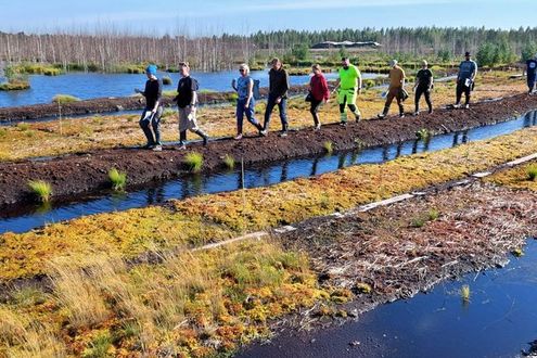
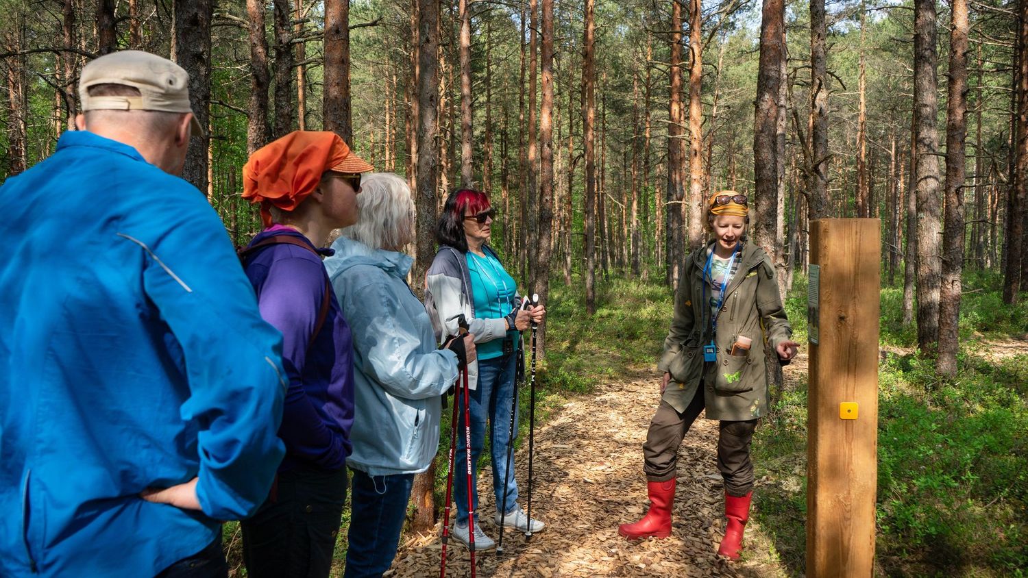
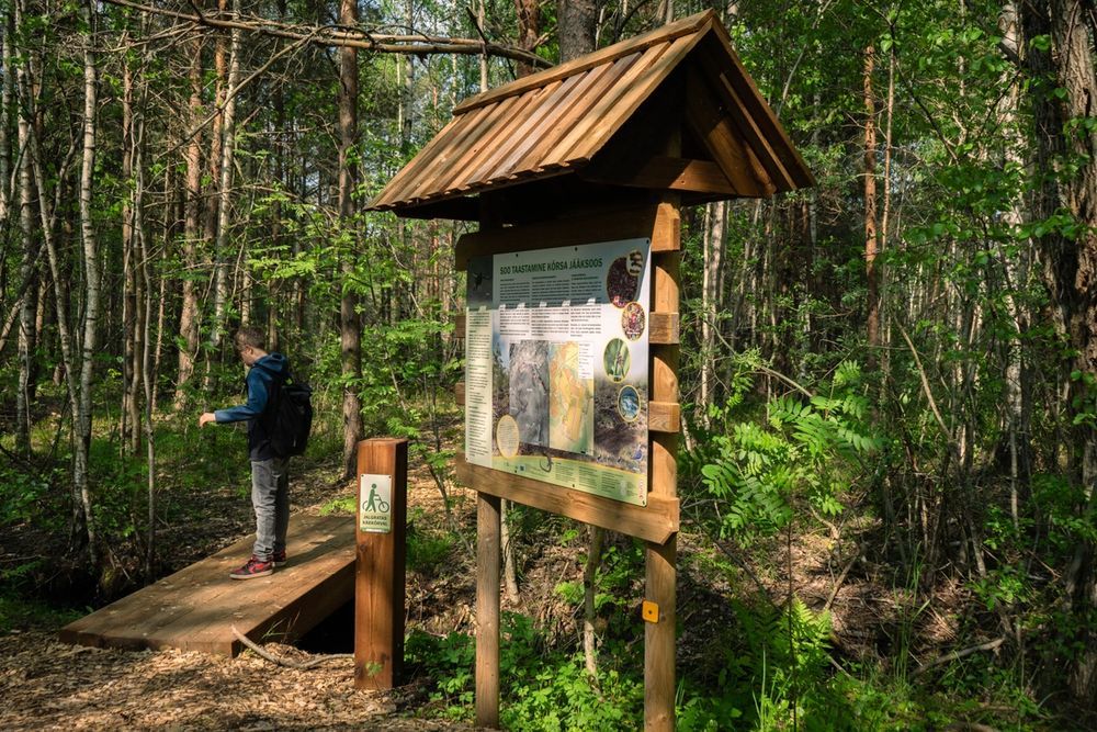
The Kõrsa citizen science trail is now open!
In 2024, restoration work began on the water regime of a small part of the Kõrsa bog, known as Saiasoo. During talks with the community, it emerged that there had once been a small hiking trail in Saiasoo, and plans soon took shape to bring it back. But not just as any trail—rather Estonia’s first citizen science trail, created with three main goals in mind:
- Community-based design – Developed together with residents living near Saiasoo, the trail aims to bring the bog “closer” to the community while offering new opportunities for exercise and relaxation.
- Restoration in action – Walking along the trail, visitors can observe how the bog is gradually returning to its natural, water-rich state.
- Citizen science – Informational posts with explanatory texts and QR codes invite visitors to learn more about the bog’s recovery and contribute data for scientists monitoring its progress.
The Kõrsa Trail is a 4.3 km circular route, with half of it now winding through the restored bog. The other half offers a glimpse of private Soviet-era houses, adding a layer of cultural history to the natural experience.
Since its opening on May 30, the trail has welcomed around 2,000 visitors. Our Estonian partners hope it will continue to serve as a source of pride, recreation, and discovery for the local community.
A short overview of the opening day of the trail with some pictures can also be found here.
Updates from Kikepera
In early 2025, a survey was carried out at the Kikepera protected area in the Saarde municipality. The survey aimed to understand local residents’ views on rewetting the Kikepera forests.
The study gathered 209 responses from local inhabitants and landowners, exploring how people relate to nearby protected areas and landscape changes.
While a large share of respondents (44%) expressed clear opposition to rewetting, the findings also revealed smaller groups with more positive (22%) or mixed (21%) opinions. Some respondents viewed rewetting as an opportunity to restore nature and reduce fire or drought risks, while others valued the drained forests as part of the current landscape and local livelihoods.
Public concerns have been raised about closing the drainage system, arguing that it would destroy the entire forest. In response to this claim, the University of Tartu conducted an analysis of the bog restoration areas that had already been restored across Estonia based on orthophotos. The results showed that more than half of the forest stands were destroyed, on only 2.8% of the forest land covered by peatland restoration areas. A more detailed overview of this study will be published soon.